


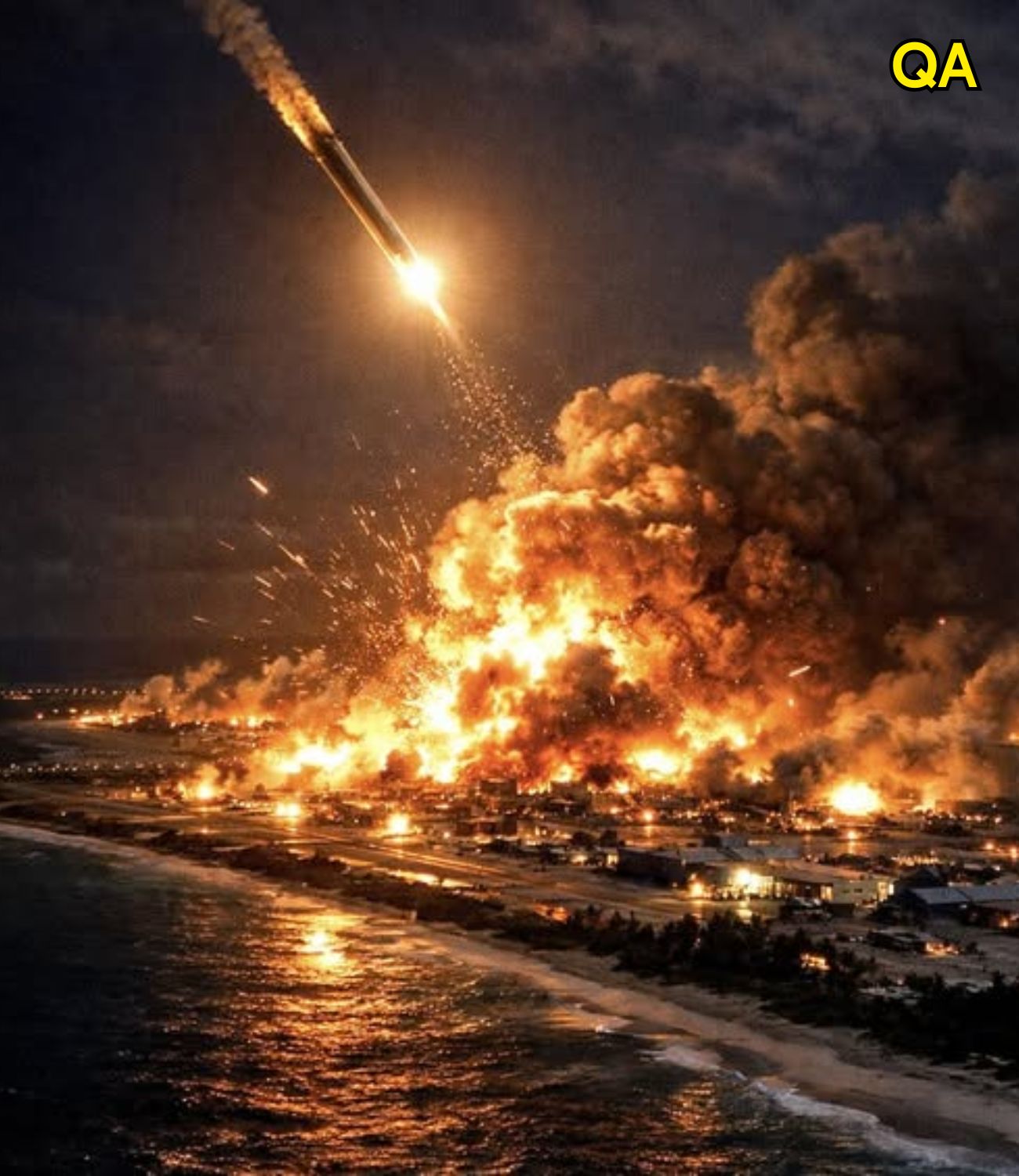
The warning arrived without diplomatic cushioning. Spoken directly into a camera, with the full weight of the office behind it, the words landed in living rooms across the country like something cold and heavy: some people will die. No elaboration. No reassurance attached. Just the blunt acknowledgment that the world had arrived at a moment where the previously unthinkable was being discussed in the plainest possible terms by the people responsible for national security.
In the weeks and months that followed, as flashpoints continued to develop across multiple continents — from the grinding conflict in Eastern Europe to the volatile calculations being made in the Middle East to the increasingly tense posture between major powers in the Pacific — a question that most Americans had not seriously entertained since the Cold War began to resurface with uncomfortable frequency. If the worst happened — if the diplomatic and military tensions now simmering across the globe finally boiled over into something that historians would later call a third world war — where in the United States would a person have the greatest chance of surviving it?
It is an uncomfortable question to ask, and an even more uncomfortable one to answer honestly. But analysts, strategic planners, and academic researchers who study conflict geography have been wrestling with versions of it for decades. Their conclusions, while not comforting in any absolute sense, do reveal a geographic logic to vulnerability and relative safety that most ordinary Americans have never had reason to think about — until now.
The Map That Missile Planners Study
Understanding which parts of the United States face the greatest strategic risk requires understanding how nuclear targeting actually works — not as it appears in films, but as it is actually practiced by the military strategists whose professional responsibility involves thinking through exactly these scenarios.
Nuclear targeting is not, in the first instance, about population. It is about capability. A nation planning a strategic strike is not primarily trying to cause the maximum number of civilian casualties in the opening exchange. It is trying to neutralize the other side’s ability to strike back — to destroy or disable the weapons, the command infrastructure, the communication networks, and the delivery systems that would allow a retaliatory response. This is the doctrine known as counterforce targeting, and it has shaped the geographic distribution of strategic risk in the United States in ways that are genuinely counterintuitive.
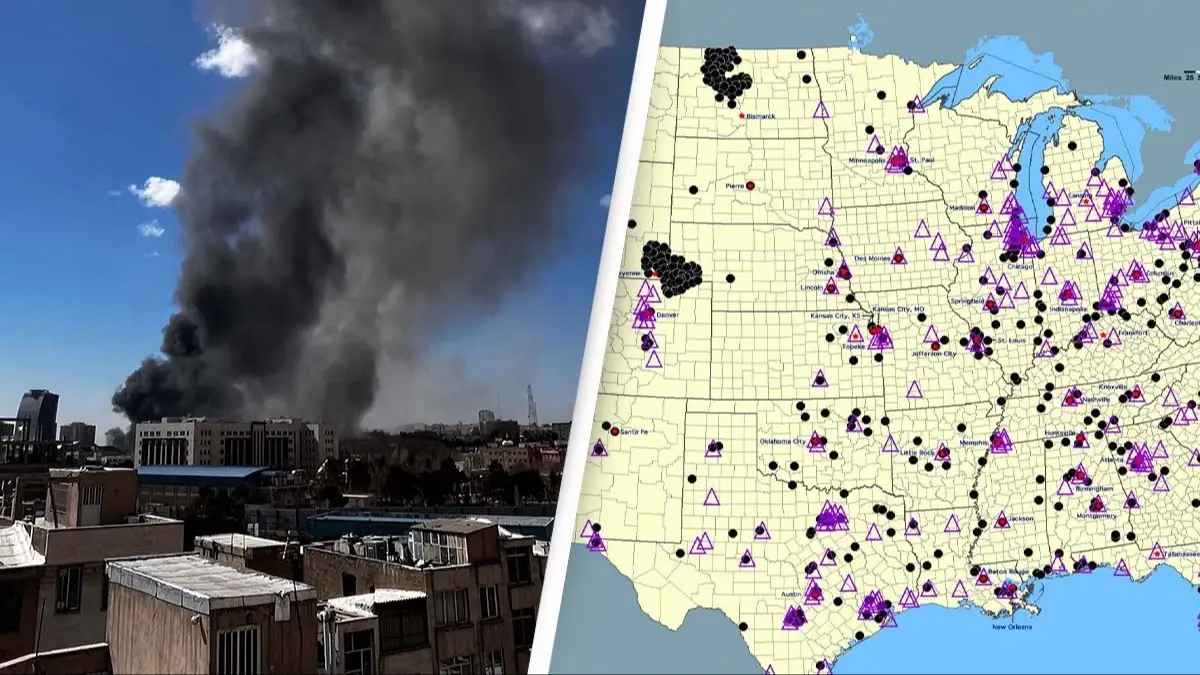
The implication of counterforce targeting is stark: the places in America that face the greatest immediate risk in a nuclear exchange are not necessarily the largest cities or the most densely populated regions. They are the places where the weapons are. And the weapons, in the United States, are not concentrated in New York or Los Angeles or Chicago. They are concentrated in the quiet, largely empty plains of the Upper Midwest and the Mountain West — in places where very few people live, where the landscape stretches to the horizon in every direction, and where the presence of hardened underground missile silos has turned ordinary agricultural land into some of the most strategically significant — and therefore most targeted — real estate on earth.
The States That Face the Greatest Immediate Risk
With this framework in mind, the states that analysts consistently identify as facing the highest level of immediate strategic risk in a large-scale nuclear exchange share a common characteristic: they host significant concentrations of land-based intercontinental ballistic missiles, major military command infrastructure, or critical strategic assets that an adversary would have compelling reasons to neutralize in the earliest phase of any exchange.
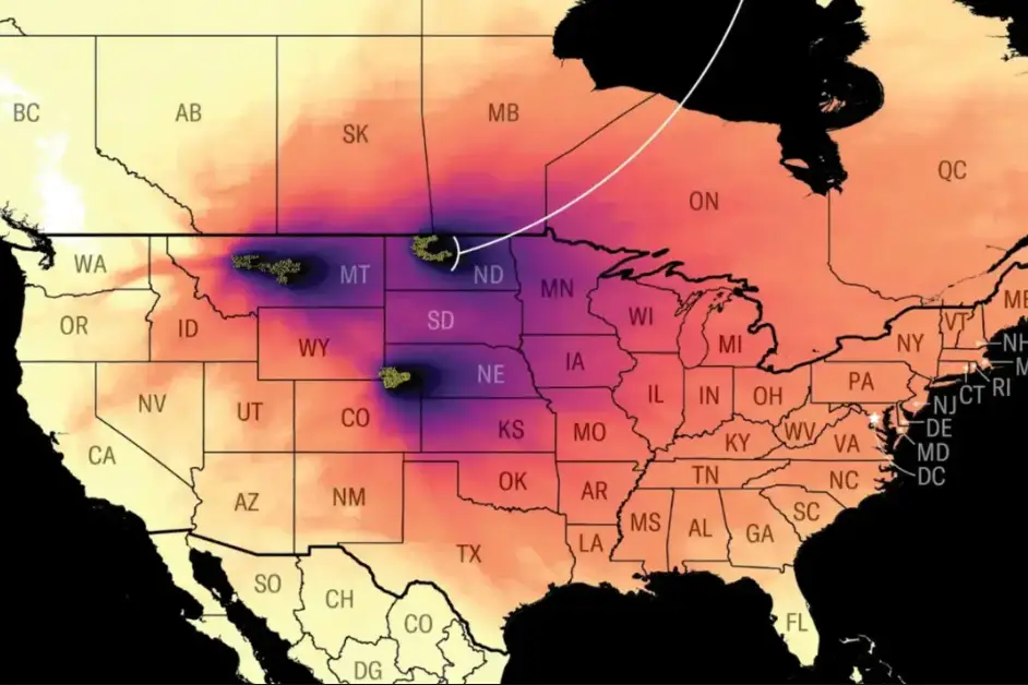
Montana sits at the top of almost every serious analysis of this kind, and the reason is straightforward: the state is home to Malmstrom Air Force Base, which serves as the operational hub for a substantial portion of the United States’ land-based missile force. The Minuteman III missiles housed in hardened silos scattered across the Montana plains represent a significant component of the country’s nuclear deterrent — which means they also represent a significant target for any adversary seeking to reduce America’s ability to respond to a first strike. The wide open spaces and sparse population that make Montana appear remote and unthreatening are precisely what made it attractive as a missile basing location — and precisely what would not protect it in the scenario under discussion.
Wyoming presents a similar picture. F.E. Warren Air Force Base, located near Cheyenne and representing one of the oldest and most storied installations in the American military, controls another substantial concentration of land-based missiles. The base’s missile fields extend across a vast geographic area, their silos distributed across the plains in patterns designed to complicate targeting — but also ensuring that a wide swath of the state falls within the zone of immediate strategic interest to any adversary capable of long-range precision strikes.
The Dakotas — both North and South — round out the core of this concern. Minot Air Force Base in North Dakota is frequently described by military analysts as one of the most strategically significant installations in the entire American nuclear force structure. It houses both land-based ballistic missiles and nuclear-capable bomber aircraft, making it what strategists call a dual-threat target: an installation whose neutralization would serve two distinct counterforce objectives simultaneously. The combination of capabilities concentrated at Minot makes the surrounding region one of the most acutely targeted areas in the country in any serious strategic exchange scenario.

Nebraska, while not home to missile silos in the same density as Montana or Wyoming, carries its own profound strategic significance. Offutt Air Force Base, located near Omaha, serves as the headquarters of United States Strategic Command — the organization responsible for overseeing and coordinating the entire American nuclear deterrent. In the language of strategic targeting, command and control infrastructure is typically assigned the highest priority among counterforce targets, because a strike that eliminates the ability to coordinate a response is, from an adversary’s perspective, more valuable than one that destroys any number of individual weapons. Offutt’s role makes Nebraska, and the Omaha area in particular, a location of extreme strategic sensitivity.
Colorado sits in a similar category for related reasons. The presence of multiple major military installations in the Colorado Springs area — including facilities that play central roles in aerospace defense, space operations, and strategic command functions — makes the state a concentration of high-value military targets that no serious strategic planner would ignore. The installations here represent not just military capability but the infrastructure through which that capability is directed and coordinated, which elevates their targeting priority considerably.
Iowa and Minnesota round out the group of states that analysts most consistently identify as facing elevated strategic risk, primarily because of their proximity to missile fields and military infrastructure in adjacent states and because of specific installations and infrastructure within their own borders that carry strategic significance. The targeting logic in these cases is less about specific high-value point targets and more about the geographic overlap between their territories and the areas of strategic interest that surround them.
The Counterintuitive Safety of Some Densely Populated Regions
One of the most striking aspects of serious strategic geography analysis is what it reveals about the relative positioning of some of America’s most densely populated regions. The East Coast megalopolis — the continuous urban corridor stretching from Boston through New York, Philadelphia, Baltimore, and Washington to Richmond — is obviously home to enormous concentrations of people and represents some of the most economically significant real estate in the country. Washington itself hosts the political and executive infrastructure of the federal government. These are not, by any measure, safe places in an absolute sense.
But — and this is the counterintuitive point — in the specific context of the early exchange phase of a nuclear conflict focused on counterforce targeting, these areas do not face the same level of immediate first-strike priority as the missile fields of the northern plains. There are no intercontinental ballistic missile silos in New Jersey or Connecticut. There are no Minuteman fields beneath the suburbs of Long Island. The strategic assets that drive counterforce targeting priorities simply are not there in the same concentration.
This does not mean the East Coast is safe. Washington would face enormous risk both as a command infrastructure target and as a symbol of governmental authority. Major naval installations along the coast carry their own targeting significance. And in any extended exchange scenario — one that moves beyond the initial counterforce phase into broader targeting — population centers and economic infrastructure would face dramatically elevated risk. The point is simply that the hierarchy of immediate first-strike priorities, as understood by analysts who study this field, does not necessarily place the most populated areas at the top of the list.
Maine’s forests, Vermont’s hills, the agricultural landscapes of much of Florida and the Southeast — these places are not targeted in the first exchange phase because they do not host the weapons and infrastructure that counterforce targeting prioritizes. They are not safe. But they may be later.
The Illusion of Safety and the Limits of Geographic Logic
Every analyst who engages seriously with this subject arrives eventually at the same conclusion: the geographic logic of strategic targeting provides a framework for understanding relative risk, but it cannot provide genuine safety in any meaningful sense. The arsenal of nuclear weapons that exists in the world today — distributed across multiple nations, in numbers that represent decades of accumulation during the Cold War and its aftermath — is large enough that the distinction between “targeted first” and “targeted later” may ultimately be a distinction without practical significance for the millions of people caught in either category.
The secondary effects of a large-scale nuclear exchange — the disruption of agriculture, the contamination of water supplies, the collapse of supply chains, the medical catastrophe of mass casualties overwhelming any remaining health infrastructure, and the atmospheric effects that climate scientists have modeled as potentially affecting food production globally for years — would extend far beyond any geographic zone that escaped the initial exchange.
There is also the important distinction between what planners might intend at the outset of a conflict and what actually happens as a conflict develops, escalates, and potentially spins beyond anyone’s capacity to control. Military history provides abundant examples of conflicts that began with clearly defined and limited objectives and ended in territory that no one at the outset had envisioned or planned for. Nuclear strategy is not exempt from this tendency — in fact, given the pressures and uncertainties involved, it may be more susceptible to it.
What Geography Can and Cannot Tell Us
The geographic analysis of strategic risk in a potential large-scale conflict is a legitimate and serious field of study. Understanding which locations host the infrastructure that makes them high-priority counterforce targets is genuinely useful knowledge — not for the purpose of enabling individuals to make decisions that would actually provide safety in such a scenario, but for understanding how deterrence works, why weapons are located where they are, and what the true geography of strategic risk looks like beneath the simplified assumptions that most people carry.
The honest conclusion that this analysis supports is both specific and general. Specific: the states of Montana, Wyoming, North Dakota, South Dakota, Nebraska, Colorado, Iowa, and Minnesota face elevated immediate strategic risk because of the concentration of nuclear weapons infrastructure within their borders. General: in the scenario being discussed, nowhere in the United States, and arguably nowhere in the world, is truly beyond the reach of the consequences that a global nuclear exchange would produce.
The value of understanding this is not that it enables better personal decisions about where to live. It is that it provides a clearer picture of what is actually at stake in the diplomatic and strategic choices that governments make in the management of international tensions — and why, for all the complexity and frustration involved, those who argue for continued investment in diplomacy, arms control, and the careful management of escalation risk are not being naive. They are being, in the most practical sense, realistic about what the alternative looks like on a map.